A Place of Ill Purpose
The Sounds of Northwest London
Features

Walking the Same Streets

Mapping 1880s Port Townsend
Text by Katrina Carrasco

Port Townsend, Washington, is a picturesque town on the northeastern tip of the Olympic Peninsula. Known for its annual wooden boats festival and active arts scene, Port Townsend also boasts a high concentration of Victorian-era buildings. These buildings are a window into the town’s past, when it was a bustling port that briefly rivaled San Francisco in terms of ship traffic. In the late 1800s, hotels, office buildings, and banks were constructed in lavish style to house the town’s commerce—and on the docks beyond them, under cover of darkness, large sums of money were also changing hands. Port Townsend in its heyday had a thriving smuggling trade, made possible in part by the quantity of trade vessels passing through, and in part by the notoriously corrupt U.S. customhouse located in town.

In the 1890s, the town went through a rapid economic rise and crash related to railroad speculation. When the promised railroad never materialized, the recently built homes and hotels were abandoned but not torn down, and many still stand today. The street grid, too, is remarkably unchanged—the town is a well-preserved slice of 1880s West Coast Americana.

I chose to set my novel, The Best Bad Things, in Port Townsend because of its rich (and rowdy) history of smuggling. One of the benefits of writing a book set so close to where I currently live was the chance to walk where my characters walked, visit some of the same buildings, and look out over Port Townsend Bay and the islands beyond.

The Bast Bad Things: Port Townsend, WA

With this map, you can virtually tour thirteen of the book’s key locations. They’re all marked here, and paired with a combination of passages from the book and photos from modern Port Townsend. Snippets of an 1880s fire insurance map can also be seen beneath the interactive map.

Clyde Imports Office / Wheeler’s Private Offices

Wheelersoffice rs

I imagined Wheeler’s offices as housed in single corner building, accessed by two separate doors: the Clyde Imports office entry on the Washington side, with a discreet internal connection to his private offices, which have an unmarked entry door on Quincy. The 1888 Sanborn map shows this corner occupied by an unlabeled building and a dwelling. Today, the entire corner lot has been leveled and paved into parking for a bank.

“Wheeler and Alma are headed for his offices, at last, only two blocks from the water. They do not take the side door on Quincy Street. In the daylight it is drab and unremarkable, withdrawn from the street atop its trio of wooden steps. Wheeler instead turns the corner at Washington Street, unlocks the shuttered Clyde Imports door. The cold room smells of ink, parchment, the polished sourness of brass.”

Wheeler’s Private Warehouse (Madison Pier)

Privatewarehouse rs

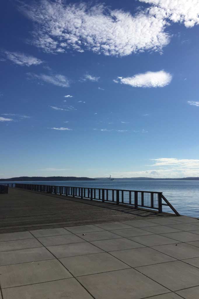
According to the 1888 map, there was no pier or other above-water structure at Madison Street. Today, a small pier exists, with the Pope Marine Building at its foot (this building is a city-owned structure available for event rentals). The accompanying photo shows the view over Port Townsend Bay from the right of the Pope Marine Building. In the novel, I created a pier at Madison because I needed a privately owned, solitary structure over the water, and the existent wharves housed multiple businesses.

“A tall plank box, it has barred, copper-paneled doors and high windows. It is on a private pier, close to Barnaby Sloan’s boardinghouse, and its entrance is frequently patrolled.”

Delphine’s House

Delphineshouse rs

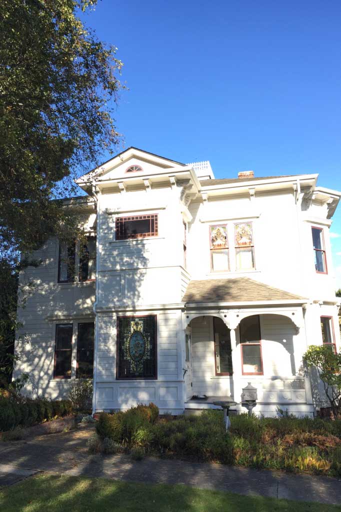
The house at this location is listed as being built in 1886; the Sanborn map also shows a dwelling here. Today it is a private home. Nestled in the heart of Upper Town, the home would have belonged to a wealthy person. On the 1888 map, it shared the entire block with only one other dwelling, providing a good deal of privacy.

“The house . . . sits tucked into the corner of a broad square lot. Two stories, painted white and lemon yellow. Angles sharp as kitchen knives, with new copper edging the roof.”

County Jail

Countyjail rs

Sanborn maps from 1884 — 1891 show this as the location of the Jefferson County Jail (the 1891 map includes the addition of a fence on the Monroe Street side). Today, private residences share this block with the Port Townsend Athletic Club.

Nell's Shop / House

Nellshousebuilding

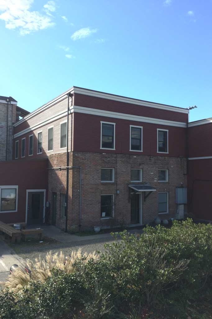
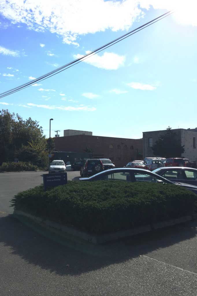
Nell’s shop and house are another corner building with two separate entrances (like Wheeler’s offices). Also like Wheeler’s offices, the 1880s-era buildings at this site have been leveled and turned into a parking lot. On the 1888 map, a dwelling occupied the corner of this block; I placed Nell’s tailor shop at the front of the Tyler side, with an alley leading around to the back on the Washington side (one of the last places Washington was part of Lower Town, before the cliff face dividing Upper and Lower Town cut into the street). This alley led to the back door of Nell’s private home. The accompanying photograph shows the building to the left of where Nell’s house would have stood; the parking lot is visible to the right.

Clyde Imports Warehouse and Chain Locker Saloon (Quincy Wharf)

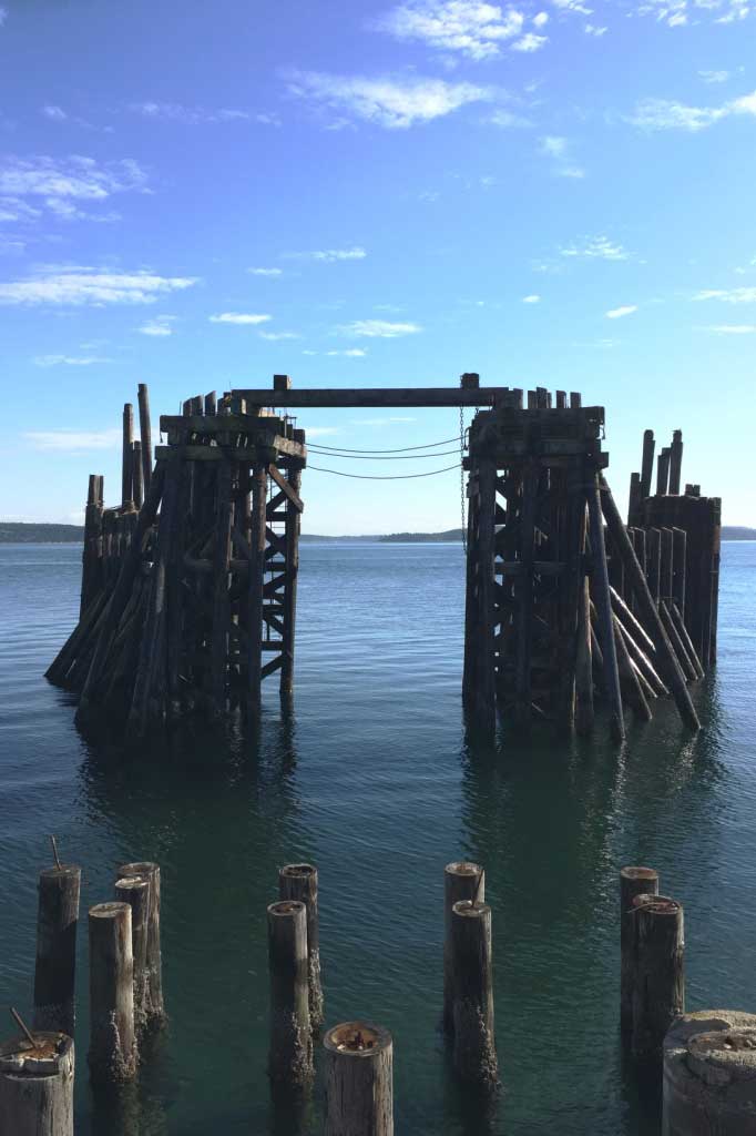
Remainsofquincywharf rs

Quincy Wharf, as documented on the 1888 Sanborn map, no longer exists. There are some pylons still visible in the water that may have formed part of the wharf’s foundation (the accompanying photo shows these remains). According to the Sanborn map, old Quincy Wharf extended about 300 feet into Port Townsend Bay. The map shows two freight warehouses, an ice house and a saloon. In the book, the saloon is Chain Locker, and one of the warehouses belongs to Wheeler.

“Out onto the long, boot-shaped expanse of Quincy Wharf . . . the narrow passage between buildings widens into a platform over the bay. On it, a triangle of buildings: the Chain Locker saloon; a freight warehouse; and on the bay side, in a prime loading spot, the tawny brick walls of Wheeler’s own Clyde Imports.”

Sloan’s Boardinghouse

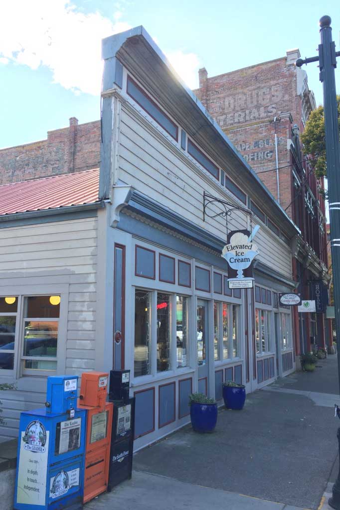
Sloansboardinghouse rs

The 1888 map lists the building at this location as a saloon, with lodgings on the second floor. Nowadays it is a single-story building that houses an ice cream and candy shop. Getting creative with the information from the fire map, I envisioned Sloan’s boardinghouse (which catered to sailors) as having a bar downstairs with rooms upstairs. Given that Sloan was modeled after a historical “crimp”—someone who kidnapped, tricked or coerced men into maritime service—this arrangement was even more appropriate: crimps often owned boardinghouses, where sailors could rack up debt for lodgings, in-house sex workers, liquor, and even clothing, and only shipping out to sea at the crimp’s convenience could settle their bill.

“Wheeler called it a sty, but Alma has seen far worse flophouses than Sloan’s boarding quarters. A two-storied clapboard building, it is marked with a simple LODGINGS sign and a row of signal flags tacked to the doorsill, spelling out for sailors what some of them might not be able to read in words . . . Inside, salvaged wood knocked together into a bar counter in one corner of the drowsy afternoon lobby.”

Customhouse

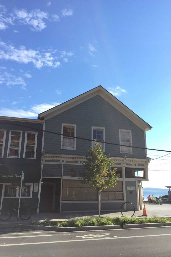
Customshouse rs

The building at the corner of Tyler and Water streets once housed the Port Townsend U.S. Customhouse. A plaque on the side of the building marks it as the site of the customhouse from 1878 – 1888. Now it is home to the Lighthouse Cafe. In the novel, the customhouse men are no friend to Alma, as her impression of the customhouse reflects.

“At the corner opposite the boatyard is a slovenly building. The United States Custom House. It has crook-shuttered windows. Peeling clapboards. A crowd of men smoking on the doorstep.”

Hoop & Barrow Saloon

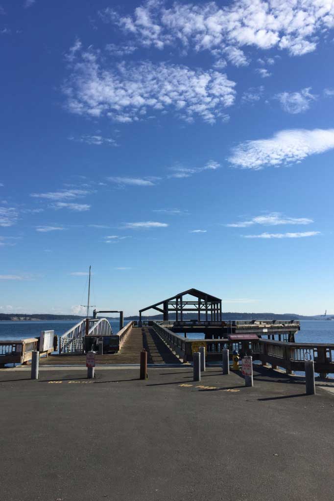
Unionwharf rs

Union Wharf still stands, though much reduced, today—a planked walkway leads to the head of the pier, where a single covered public pavilion hosts informative signs about Port Townsend Bay. In 1888 the wharf was far more crowded: a saloon, a shipping company, and two freight warehouses lined the south side of the middle wharf, while two larger freight warehouses occupied the head. I located Hoop & Barrow in the space marked as a saloon on the 1888 map; some historical photos circa 1890 identify this building as The Pacific Bar.

The Captain's

Thecaptainsleft1stnatlbankright rs

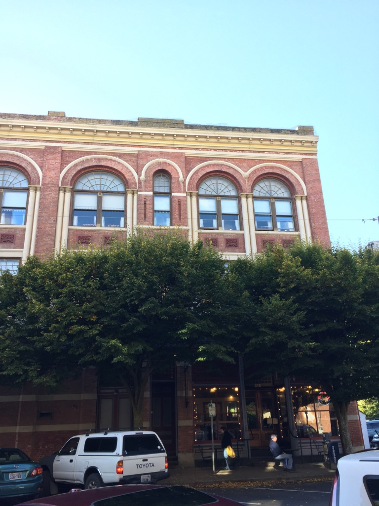
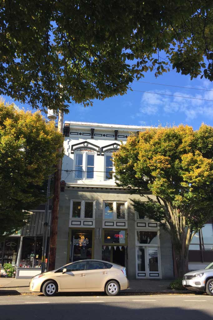
This building is marked on the 1888 map as Lodgings/Saloon. It sits directly to the left of the First National Bank, which was constructed in 1883. The accompanying photo shows the bank building now, which still stands with its original triple-window design and peaked second floor window trim. Historical photos identify the bar as the Philadelphia Saloon. Today a bookstore occupies the space. In the novel, The Captain’s is a popular saloon where men can buy a dance (and sometimes more) from the women working there.

“A gold sign across the road reads THE CAPTAIN’S. This is the dance hall where Nell works sometimes, according to Wheeler . . . She stops to take out a cigarette in the light of the window. Behind the fogged glazing, dancers whirl on a square floor, girls in gay dresses, men in calico shirts and dented hats. A fiddle band sways on a raised platform.”

Sloan's Cannery

Sloanscannery rs

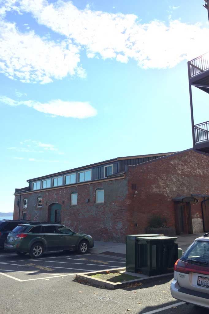
This building is marked on the 1888 map as warehouse with a stone foundation. A stone-and-brick building stands there today. Interestingly, the modern building has a door frame reading: “Clam Cannery 1885.” This was one of the book locations where I built upon suggestion, and used it as the place where Sloan’s questionable cannery operated. The cannery hosts some grim events in the book—nothing as pretty as its bright modern façade would suggest.

“The cannery is a boxy space. High ceilings. Reek of piss and blood and moldy straw. Cut in two by a brick wall at its center. The stench of broken bodies everywhere, but there’s just rusted canning-line machinery and empty crates, stacked tall, dim lamplight slitting through their boards.”

The Cosmopolitan Hotel

Cosmopolitan rs

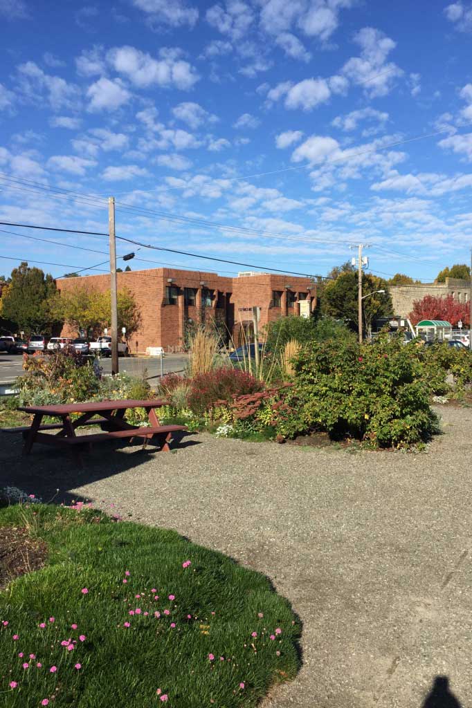
The Cosmopolitan Hotel was built in 1858 and stood until 1901, when it was torn down to make way for a bakery. Today the lot is home to Adams Street Park, a tidy green space overlooking the bay. A July 18, 1901, article from local newspaper The Morning Leader described the old hotel as “the headquarters for the sporting element of Puget Sound . . . poker games were running in the bar room both day and night, and during 24 hours, it was not an uncommon thing for from $300 to $400 worth of cards to be used and thrown on the floor.” When the hotel began to acquire a rougher reputation (it was the site of stabbings, brawls, and other altercations) and wealthy folks began to take their business elsewhere, the owners split it into two sections—one for sailors and one for richer clientele). This split happened in 1885, but the barroom and gambling parlor remained shared.

Sing Tai’s Shop

Singtais rs

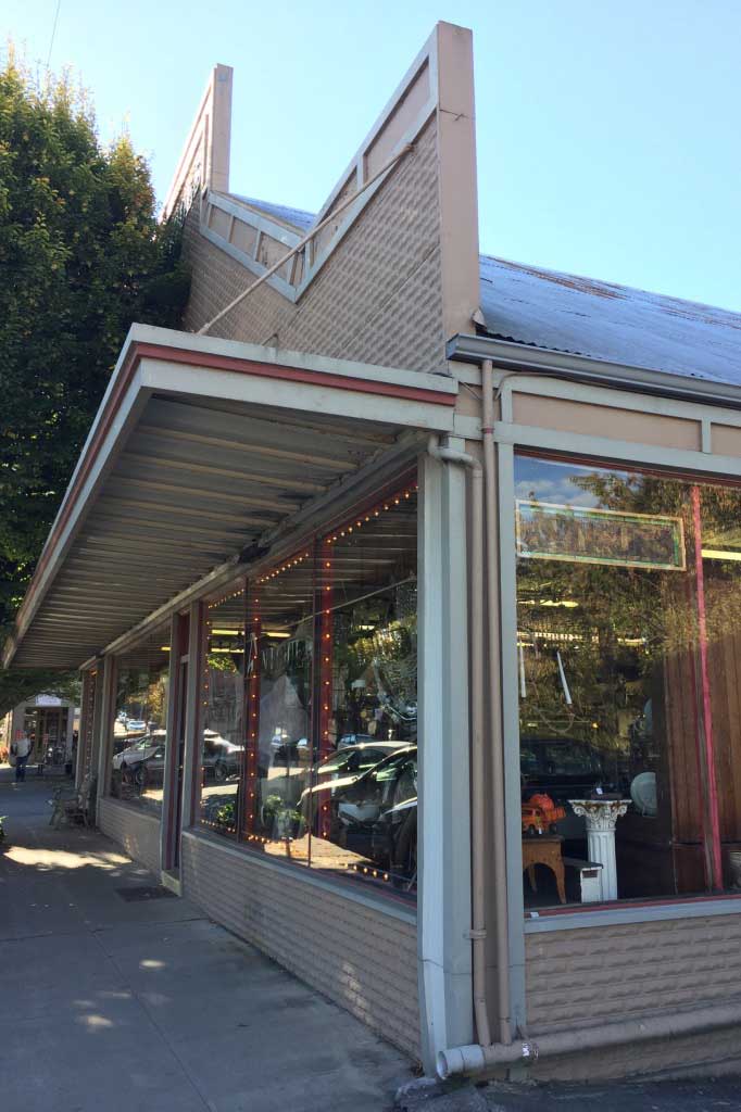
The 1888 Sanborn map lists this building as a Chinese Grocery, with a Chinese washhouse to the right and dwellings to the left. Other surrounding buildings are the Seaman’s Union, a bake house, and other structures simply marked “Chinese.” Today the entire corner of the block is home to an antique mall.


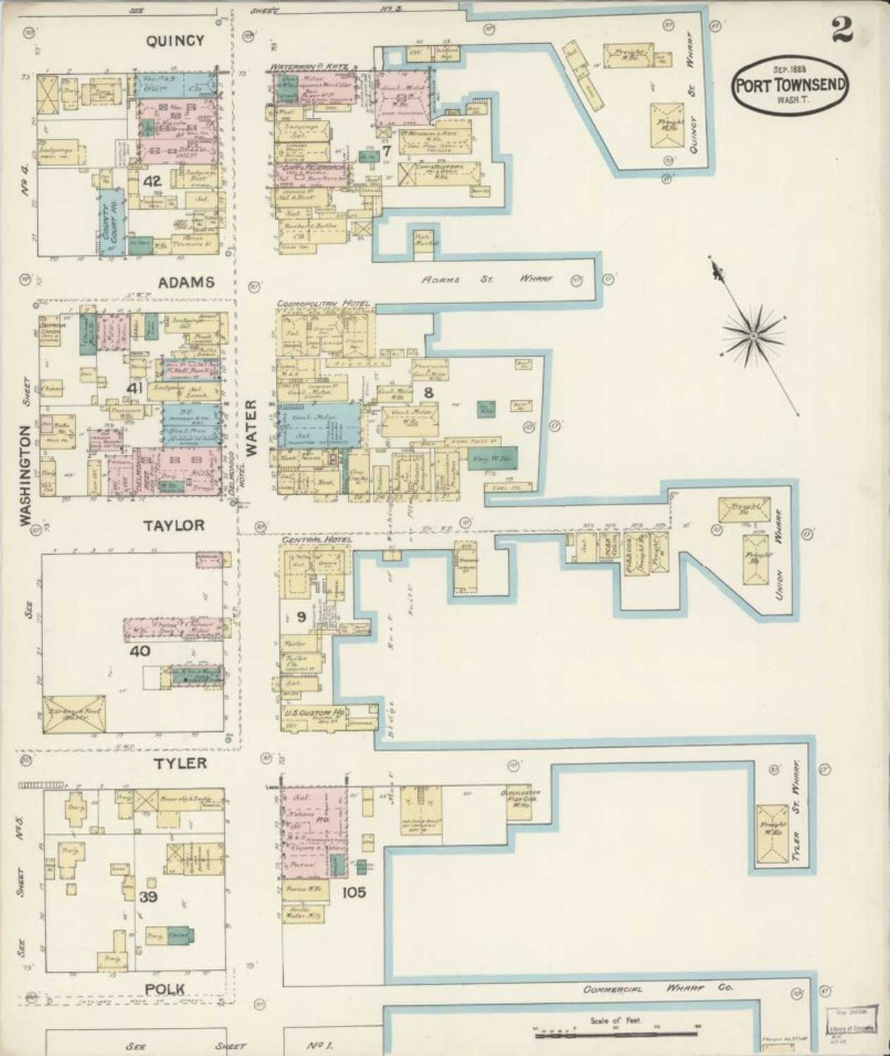
Sanborn Fire Insurance Map, 1888


This fire insurance map, issued by the Sanborn Map Company in 1888, was a primary resource when I was writing The Best Bad Things. I also referenced Thomas W. Camfield’s Port Townsend: An Illustrated History to cross check building locations, structural details in historic photographs, and more. The Sanborn map is dated September 1888, which places it almost a year and a half after the events of the novel take place, but it is the most detailed map available for Port Townsend at that time.
Sanborn fullmap
When crafting the world of the novel, I tried to stick close to what the Sanborn map suggested: if it listed a corner lot as a saloon, I would place a saloon in that location in the book. I used this method to populate the Port Townsend of the novel with grocers, lodgings, a post office, a bank, and more. Where it served the novel, I deviated from the map. Perhaps the biggest anachronism in the story world is the existence of Madison Pier (see entry No. 2 for more about this structure). All this to say: while I leaned heavily on historical materials to create the world of the novel, it is, in the end, a work of fiction.


The Best Bad Things book cover

The Best Bad Things

MCD × FSG, 2018

“A brazen, brawny, sexy standout of a historical thrill ride, The Best Bad Things is full of unforgettable characters and insatiable appetites. I was riveted. Painstakingly researched and pulsing with adrenaline, Carrasco’s debut will leave you thirsty for more.”
—Lindsay Faye, author of
The Gods of Gotham

A vivid, sexy barn burner of a historical crime novel, The Best Bad Things introduces readers to the fiery Alma Rosales—detective, smuggler, spy


It is 1887, and Alma Rosales is on the...
See full details